Market Update 12/29/2023
GENERAL MARKET TRENDS
POTENTIAL MARKET DISRUPTORS
PORT IMPACTS:
- Port Recovery not expected until 2025.
- Previously, the west coast was yielding more tonnage to the east, we are now seeing it return to the west.
SEASONAL TRENDS:
- We’re seeing a notable reduction in market capacity, driven by factors like bankruptcies, holiday periods, and operators sidelining their trucks.
- This, coupled with declining load volumes and increasing rejections, is setting the stage for a distinctive trend.
- First week of Q1: Expect a surge in rates.
- This is a direct consequence of the tightened capacity and the current market’s response mechanisms.
- After first week of Q1: Anticipate a shift as truck capacity re-enters the market.
- This change, along with a rebound in load volumes, will lead to a decrease in rates, eventually stabilizing after an initial fluctuation in January.
TRANSPORTATION EVENTS:
UPCOMING HOLIDAYS:
- New Years (Monday, January 1)
- Chinese New Year (Saturday, February 10)
- Ramadan begins (Sunday, March 10th)
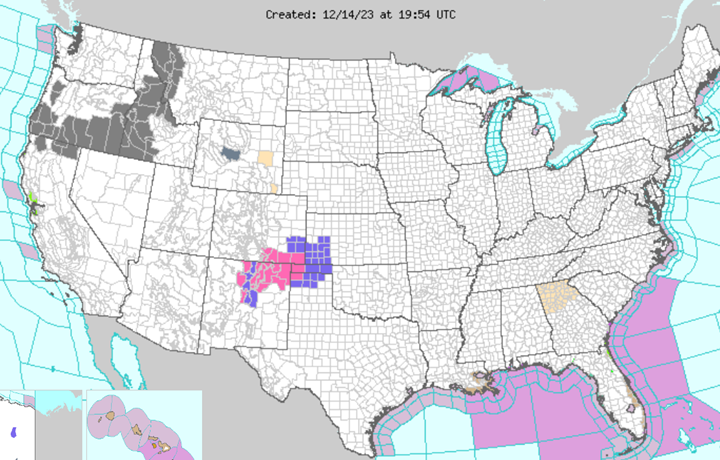
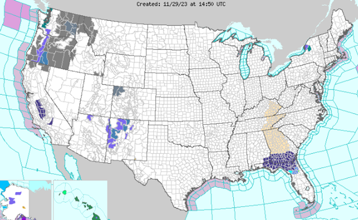
WEATHER IMPACT
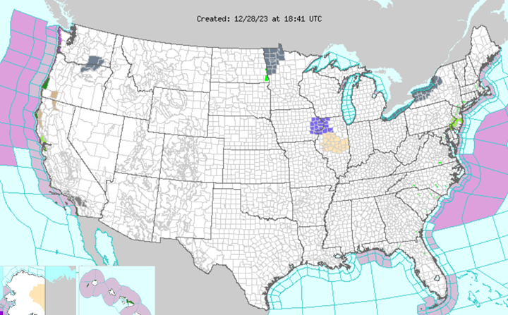
Northern and Central Plains
Current Situation: Winter weather warnings and advisories related to the recent blizzard have been discontinued.
Forecast: The upper-level circulation associated with the storm will gradually diminish. Mixed rain and light snow are expected to taper off by the afternoon.
Midwest
Forecast: Wrap-around moisture from the Great Lakes will bring mixed rain and wet snow today, with only minor snow accumulations due to temperatures being just above freezing.
Northern Mid-Atlantic to Southern New England
Weather Event: A strengthening coastal low is causing moderate to heavy rain.
Impacts: Potential for excessive runoff and flooding, minor coastal flooding expected in the New York City metro area due to high tides.
Movement: The heavy rain will move across southeastern New England by the afternoon, with the possibility of moderate rain rotating back towards the southeast New England coast later.
Northeast and Maine
Forecast: On-and-off rain showers will linger, potentially changing to light wet snow over Maine on Friday. Light wet snow will also continue along the Appalachians.
Florida
Forecast: A round of rain is expected to pass through southern Florida, influenced by a subtropical jet stream and a low-pressure wave.
West Coast
Weather Systems: A couple of large Pacific cyclones.
Forecast: These will produce unsettled weather, with rain and high-elevation snow over the Pacific Northwest and California. Dry conditions are expected for much of the rest of the western U.S., with mixed precipitation reaching the Great Basin by Saturday morning.
Temperature Trends
- Northern Tier and Western U.S: Milder than normal temperatures
- Southern Tier to Southeastern U.S: Cooler than normal conditions will shift across these regions.
- Notable: Mild overnight temperatures from the northern Plains to the Northeast are expected to be more than 20 degrees above normal, likely setting records for warm minimum temperatures, especially this morning.
WPC’s Short Range Public Discussion (noaa.gov)
INDUSTRY NEWS TO KNOW
- US ports by volume: How maritime cargo trends are stacking up | Supply Chain Dive
- California holds off on only allowing new zero-emission vehicles in drayage registry – FreightWaves
- After dropping for 8 weeks, benchmark diesel price turns higher – FreightWaves
- Retailers Are Bracing for Their Postholiday Returns Hangover – WSJ
- Freight cycle bottom continues to form in November – FreightWaves
- We’re still at risk for another ‘everything shortage’ – FreightWaves
- Logistics companies race to adapt to shifting supply chains | Supply Chain Dive
- As manufacturers turn away from China, Vietnam lures investment | Supply Chain Dive
Like being in the know? Get our biweekly Logistics Market Report delivered straight to your inbox. Sign up here.